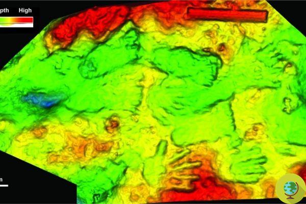
It is located in Leuhan, Brittany, one of the oldest maps ever found in Europe. It dates back to 4000 years ago and represents the territories of a principality of the Bronze Age.
He is about to end up run over, his mother saves himIt is located in Leuhan, Brittany, one of the oldest maps never found in Europe. In fact, the cartographic representation engraved on a funerary slab dates back to 4000 years ago, which was recently analyzed by researchers of the'French Preventive Archaeological Research Institute (Inrap), the University of Bournemouth and the University of West Brittany.
It is a trapezoid, a horizontal and a vertical axis, in which lines, both straight and curved, but also squares, circles, ovals that intertwine have been engraved.
The gray-blue funeral slab of Saint-Bélec is made of schist and is 2,20 meters long, 1,53 wide and 16 centimeters thick. The archaeologist discovered it in 1900 Paul du Chatellier, who kept it in his villa in Chateau de Kernuz, which later became a private museum.
The collection was then acquired by the National Antiquities Museum in Saint-German en Laye. However, only in recent years the slab has aroused the interest of archaeologists, who realized that those engravings represented territories of a principality dating back to the Bronze Age.

@INRAP
In particular, there are three elements that led the researchers to believe that it was a map. "A homogeneous composition with engravings identical in technique and style, a repetition of motifs and a spatial relationship between the motifs themselves, or rather a network of lines" observe the scholars who then compared the engravings on the plate with other prehistoric drawings of populations such as the Tuareg and Australian Aborigines.
@INRAP
According to Inrap experts there is no doubt that it is a cartographic map. This could refer to an area of about 30 km of the Odet river valley, in western France.
“Some lines indicate the river network. We tested the similarity between the engravings and the elements of the landscape through a series of statistical analyzes ”explain the archaeologists who examined it.
From the research of the French experts it emerged that the Saint-Bélec slab depicts the territory of a strongly hierarchical political entity dating back to the early Bronze Age. And for French archaeologists it could be the oldest map ever found in Europe to date.
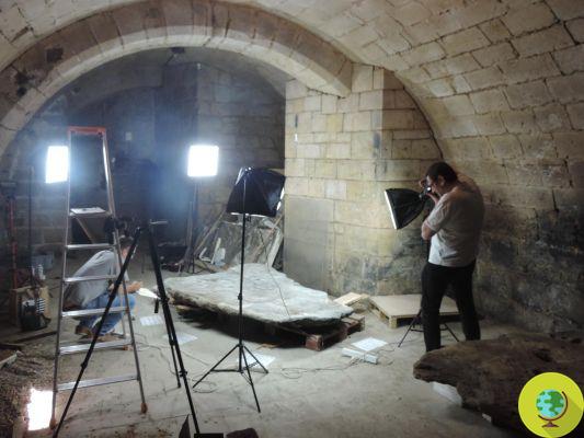
Cast iron: Inrap
Read also:
- Outstanding archaeological discovery: oldest woven basket found so far
- 38-year-old archaeologist finally manages to decipher the Linear Elamite, the mysterious writing of 4000 years ago
- New outstanding archaeological discovery in Egypt: another 50 intact sarcophagi dating back to 3000 years ago found